Using cutting-edge technologies to simplify the process of obtaining proof of property ownership in Zanzibar
Our solution is designed to simplify and modernize the outdated, paper-based data collection and parcel mapping processes, all while tackling the challenges of limited professional capacity and high costs of land data collection. By teaming up with the Commission for Lands and leveraging cutting-edge technologies like drone imagery, digital tools, and cloud computing, we’ve created a more efficient way to issue land certificates in months instead of years. Our approach is built on several key components, each addressing a specific challenge we’ve identified.
The first step was digitizing the data collection process. We moved away from paper-based methods to digital tools, which improved data capture, imrpoved security, and solved the common problem of lost paper records. With digital methods, we could store and manage land data more effectively, making it both secure and easy to access.
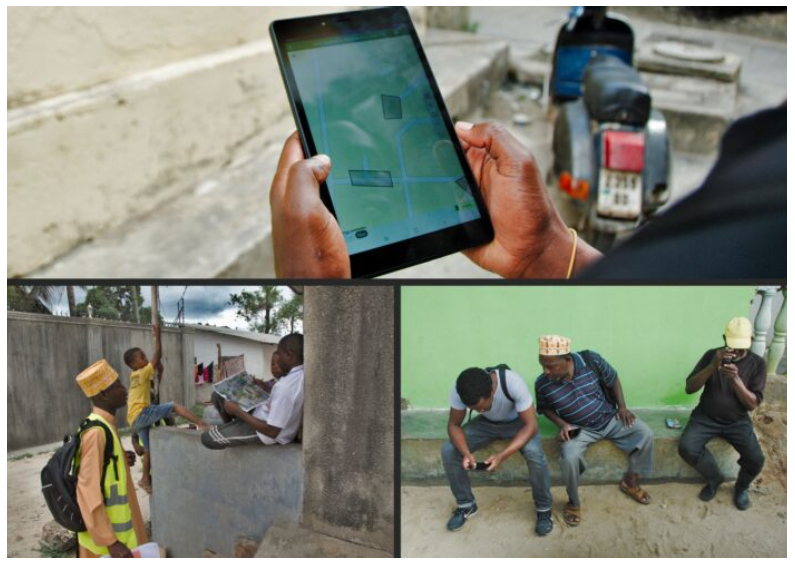
Next, we developed a parcel mapping solution that uses high-resolution aerial imagery from drones and geolocation capabilities built into tablets. This innovative, cost-effective approach provides sub-meter accuracy for parcel demarcation – meeting all legal requirements, but at a fraction of the cost and time of traditional methods. By using drones and tablets, we can create accurate, reliable maps faster and more affordably.
Thanks to the support from the Cadasta Foundation and customizations made to ESRI‘s ArcGIS Survey 123, we integrated the digital data collection and parcel mapping into one easy-to-use tool. This tablet-based software allows for real-time capture of parcel boundaries and landowner information, dramatically reducing the time and cost involved. By streamlining the entire data collection process, we’ve made it much more efficient and accessible to landowners and other stakeholders.

For data collection, we tapped into Zanzibar’s tech-savvy youth, training a dozen young people to use our newly developed tool. We also worked with local government surveyors to help manage the trained youth, solving the challenge of limited human resources by creating a larger pool of workers. This not only sped up the data collection process but also ensured the work could be done more efficiently. By involving the local communities and building their capacity, we created a sustainable solution that allowed the people of Zanzibar to take control of the land adjudication process.
We also made the adjudication process easier and more affordable for landowners by bringing the data collection to their doorsteps. This door-to-door approach saved landowners time and money – no longer did they have to make the long journey to land adjudication offices. It also encouraged participation from marginalized landowners who may have been previously excluded, making the entire process smoother for everyone involved.
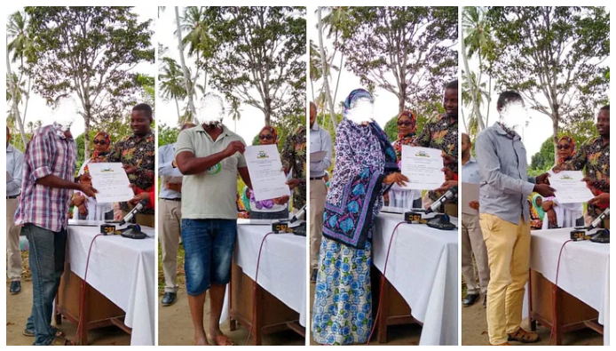
The results speak for themselves as our digital data collection solution drastically improved the traditional methods. Where the old approach took at least 24 months (including legally required waiting periods) to collect land data, our solution documented over 1000 land parcels and issued more than 100 government-approved land titles in just a few months. This proves that it’s possible to issue land titles on a larger scale, faster, and at a lower cost. Our approach has received strong support from stakeholders including the government, survey professionals, and landowners, who recognize it as a forward-thinking and effective solution to land documentation.
Our solution has the potential to transform land adjudication in Zanzibar, making it easier for people to access and secure their property rights.

Additional information about the initiative can be found here:
https://news.trust.org/item/20220726100224-q05uk
https://www.reuters.com/article/tanzania-housing-tech-idUSKBN2841O4