Discovering Friendship, Resilience, and Beauty in Kenya’s Taita Hills
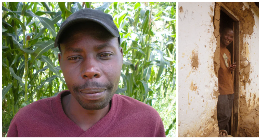
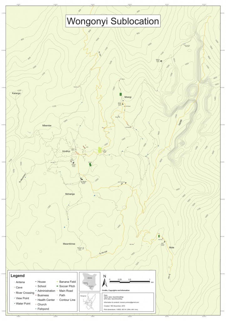
In 2010, I did my first solo cartography project in Africa. Before coming to Kenya in 2009, I had already established a connection with Ronald Mdawida, the director of Kosmos Solutions International, an NGO working in both the Taita Hills and Nairobi’s informal settlements. Since I had time to spare while traveling around East Africa, I met Ronnie, and with just a GPS device and a laptop, we headed to the village where he was born, Wongonyi, located near the Kenyan coast in the middle of Taita Hills.
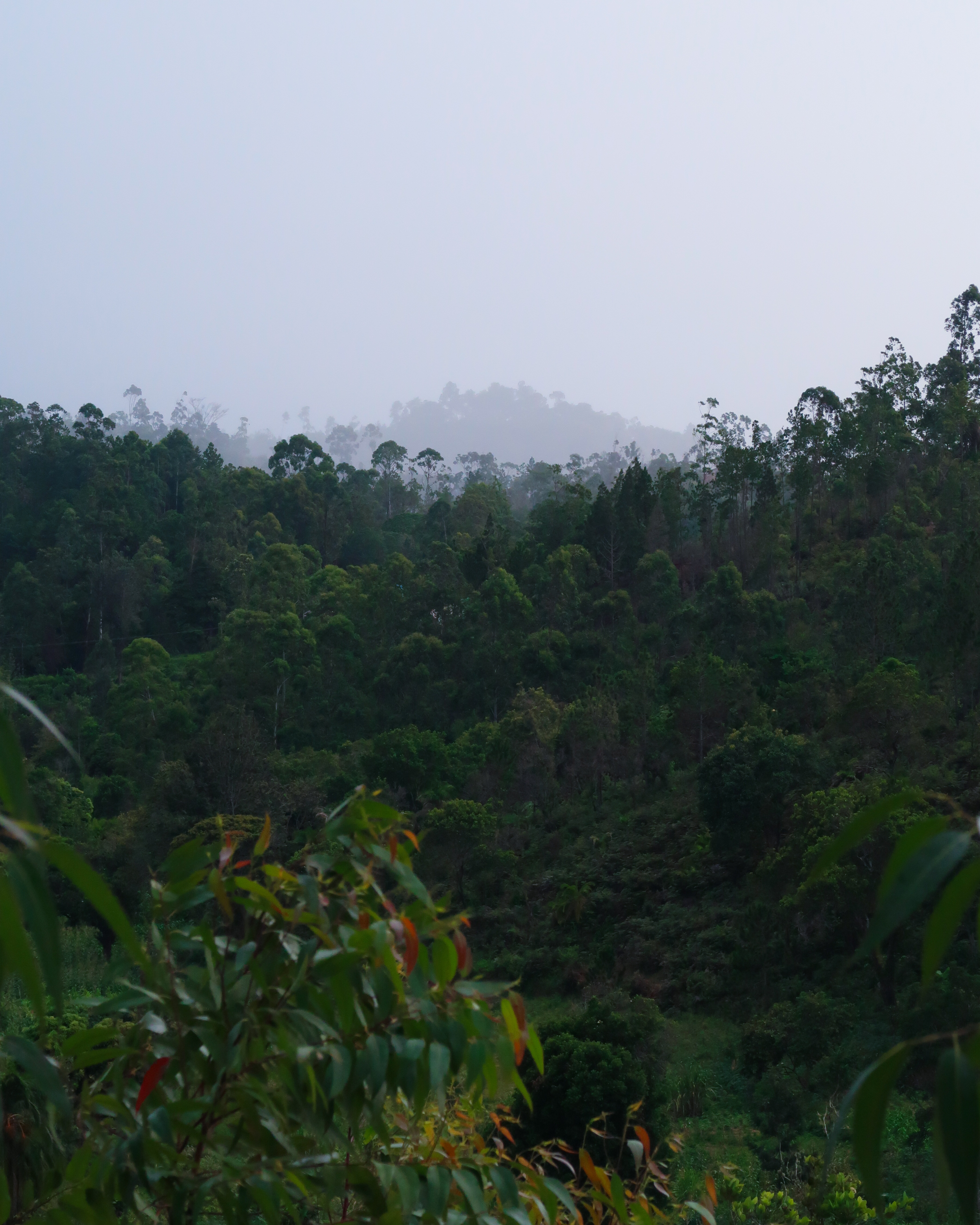
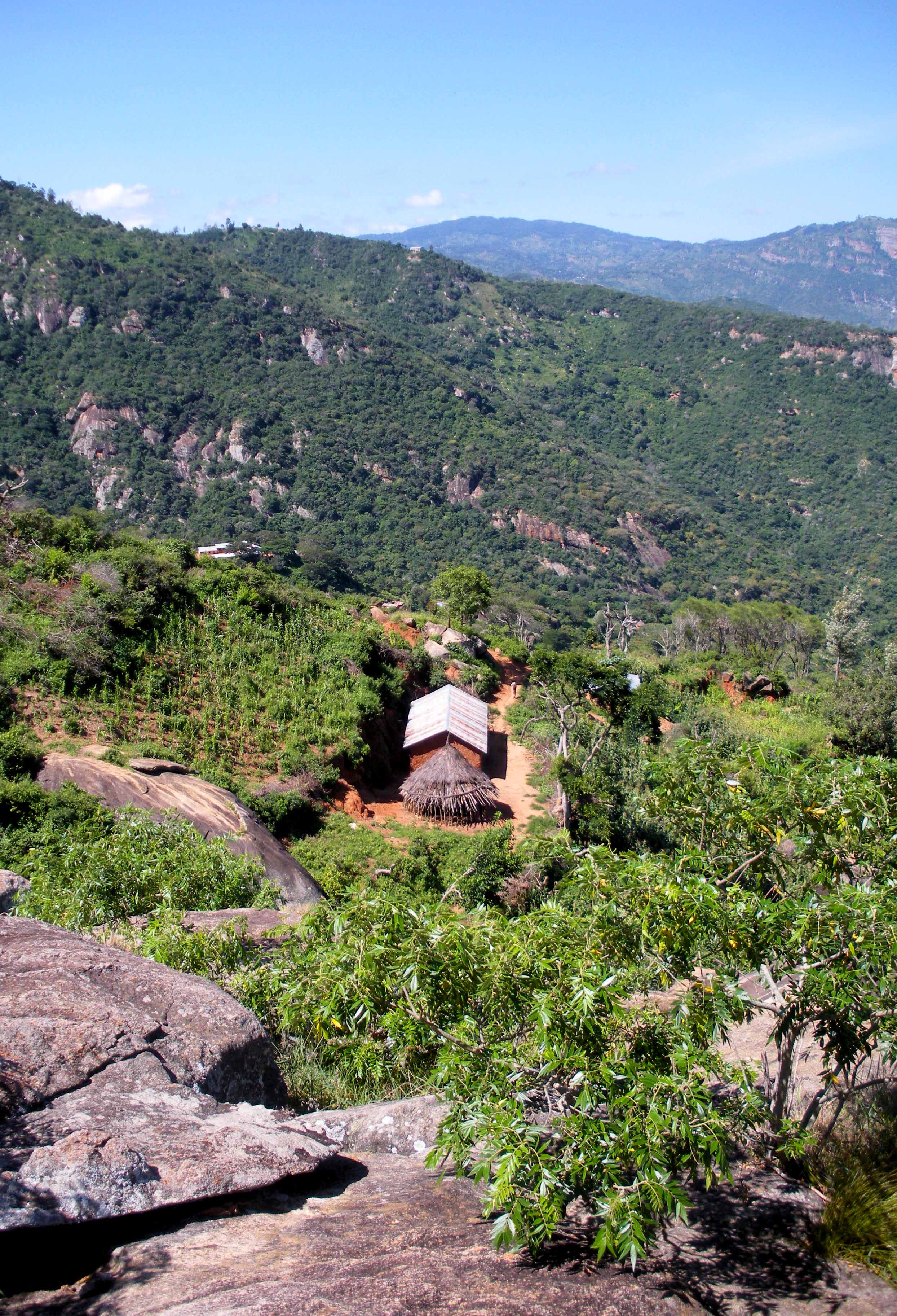
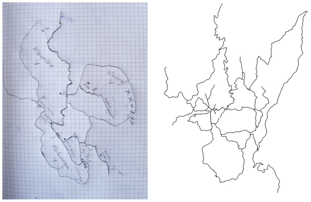
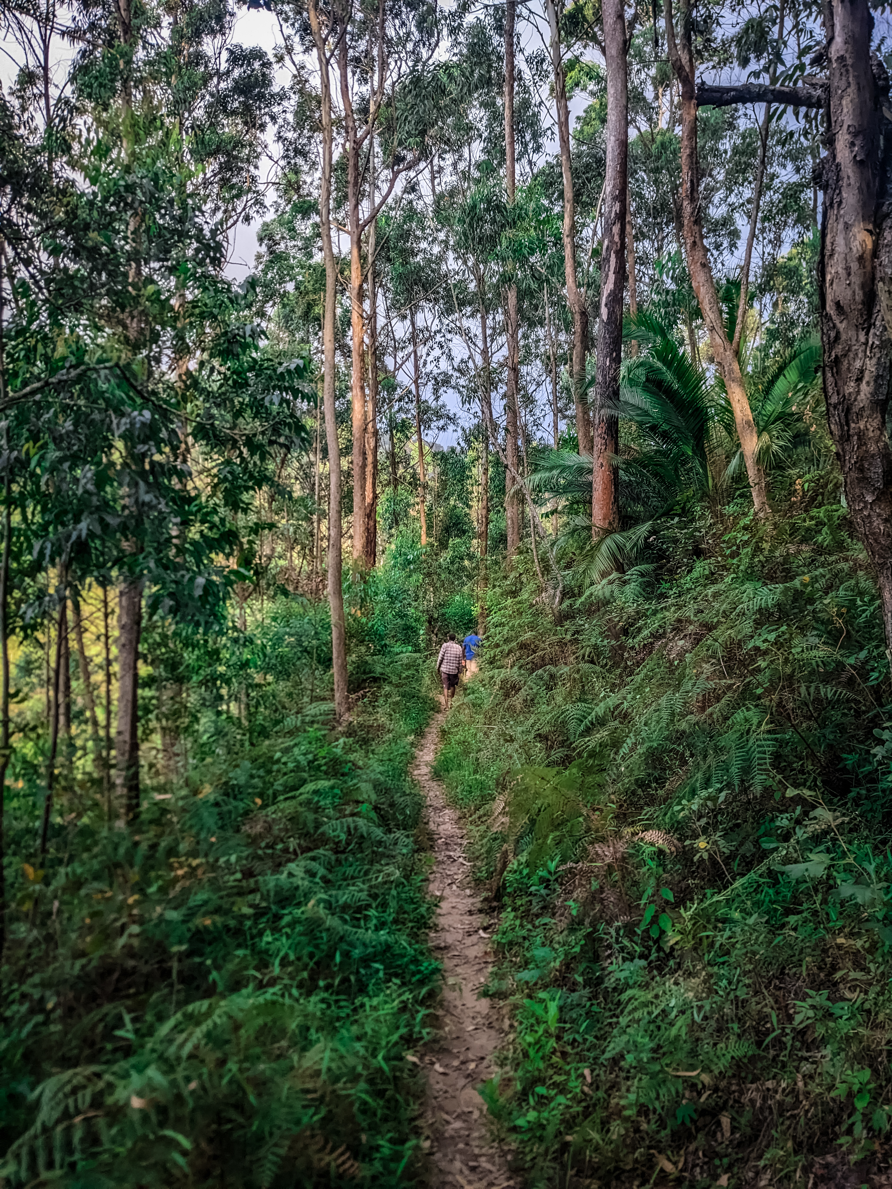
Electricity was still non-existent within the area at that time. After spending a few days relaxing and getting to know my surroundings, I had a chat with the local chief about my plan to map the village. He decided that I should map the entire Wongonyi Sublocation, covering five villages. The goal was ambitious, to say the least. I planned to chart every home, public structure, and key amenities like water points. I had no idea what to expect but was excited to get started and to see what the final map would reveal. Taita Hills are one big hilly expanse, and for a clearer understanding of the paths and locations of points of interest, I asked my guide, and now my friend, Isaiah, to sketch the locale for me. I later noticed that his sketched map looked very similar to the GPS traces.
Initially, the task seemed manageable, but I quickly felt overwhelmed. The expansive, rugged terrain, under the relentless sun, took me by surprise and showed me just how ill-prepared I was. I suffered blisters on my ears from not wearing a hat and on my feet from walking. Then there was exhaustion from the heat, altitude, and challenging terrain. All of these were challenges to overcome with good planning and preparation, but the kindness of the Wongonyi people proved to be an even bigger obstacle to getting work done in any meaningful time. Each house visit turned into an invitation for tea, meals, or snacks, coupled with conversations about our project, memories, the weather, or life in general. These meetings while beautiful were extremely time-consuming. This led Isaiah and me to adopt a stealthier approach to mapping. Avoiding detection, we would emerge from the bushes, record our data, sketch the surroundings quickly, and disappear into the forest, in a style we named “guerrilla mapping.”
A month had passed and the map began to materialize before our eyes. The locations of man-made structures were heavily influenced by the terrain, which I wanted to accurately depict, so I created contour lines, essential for the map’s final rendition. I tagged all the contour lines with elevation data, so converting the map into a 3D representation was a straightforward step.

This was my first solo experience, far from home, in a country I am yet to know, among the people who would soon become my lifelong friends. This experience also introduced me to the realities of rural life in Kenya. My friends there face daily struggles, from nearly impassable roads to under-resourced public facilities, and scarce employment opportunities.
The experience in Wongonyi was transformative for me personally. It was here where I felt my calling if you will, laying the groundwork for my approach to work and providing valuable lessons for my subsequent work, first at Map Kibera, and then at my company Spatial Collective.
Included below is the completed map. The photographs in this piece were taken with a film camera in 2010.
Leave a Reply